The Courses
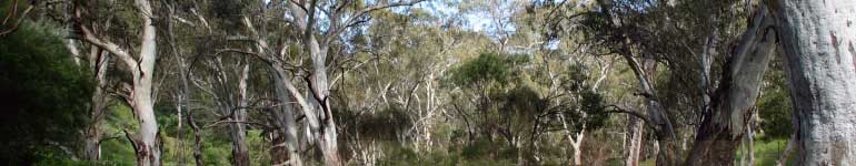
The 31.45 kilometre Long Course and 16.77 kilometre Short Course borders on, and passes through, the World Heritage listed Wollemi National Park. Runners are exposed to sweeping expansive views over the Wollemi National Park, across the mountains to the Sydney skyline. As both courses traverse private property access is ONLY available to runners on race day.
Starting at the Bilpin District Hall, runners will travel in a westerly direction for about 600 meters along the road easement then enter a fire trail in the National Park till they reach Mt Tootie Rd. Runners cross Mt Tootie Rd and enter a Telstra trail that runs parallel to Mt Tootie Rd.
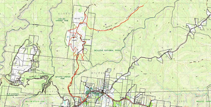
LONG COURSE MAP
Google Earth Map
short course google map
drink stations
Includes elevations
LONG COURSE - 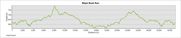
Bilpin District Hall to Drink Station 1 - Itchenstoke Gates
Starting at the Bilpin District Hall, runners will travel in a westerly direction for about 600 meters along the road easement then enter a fire trail in the National Park till they reach Mt Tootie Rd. Runners cross Mt Tootie Rd and enter a Telstra trail that runs parallel to Mt Tootie Rd.
Run distance 4.715 kilometres
Drink Station 1 - Itchenstoke Gates to Drink Station 2
Course continues from the Itchenstoke Gates to the top of Mt Tootie.
Run distance 3.18 kilometers (Progressive 7.89 kilometres)
Drink Station 2 to Drink Station 3
Course continues down hill and through a gate, into a bush track, known locally as the 'bus track'.
Run distance 3.67 kilometers (Progressive 11.56 kilometres)
Drink Station 3 to Drink Station 4
Continue along the 'bus track' until you reach a marker where the course turns back upon itself.
Run distance 5.04 kilometers (Progressive 16.60 kilometres)
Drink Station 4 to Drink Station 5
Return through gate and run up to the top of Mt Tootie.
Run distance 5.03 kilometers (Progressive 21.64 kilometres)
Drink Station 5 to Drink Station 6
Return back through Itchenstoke Gates.
Run distance 5.02 kilometers (Progressive 26.67 kilometres)
Drink Station 6 to Drink Station 7
Continue along Mt Tootie Road until directed back along trail towards the Bilpin District Hall.
Run distance 3.17 kilometers (Progressive 29.84 kilometres)
Drink Station 7 to Finish
Follow course back to the finish line at the Bilpin District Hall
Run distance 1.6 kilometres - TOTAL DISTANCE 31.45 kilometers
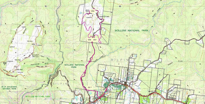
SHORT COURSE MAP
SHORT COURSE -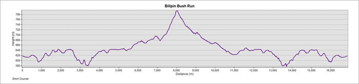
Bilpin District Hall to Drink Station 1 - Itchenstoke Gates
Starting at the Bilpin District Hall, runners will travel in a westerly direction for about 600 meters along the road easement then enter a fire trail in the National Park till they reach Mt Tootie Rd. Runners cross Mt Tootie Rd and enter a Telstra trail that runs parallel to Mt Tootie Rd.
Run distance 4.715 kilometres
Drink Station 1 - Itchenstoke Gates to Drink Station 2
Course continues from the Itchenstoke Gates to the top of Mt Tootie.
Run distance 3.18 kilometers (Progressive - 7.895 kilometers)
Drink Station 2 to Drink Station 6
Continue on the marked course, around Mt Tootie back to Drink Station 6.
Run distance 4.09 kilometers (Progressive - 11.989 kilometers)
Drink Station 6 to Drink Station 7
Continue along Mt Tootie Road until directed back along trail towards the Bilpin District Hall.
Run distance 3.175 kilometers (Progressive - 15.164 kilometers)
Drink Station 7 to Finish
Follow course back to the finish line at the Bilpin District hall
Run distance 1.6 kilometers - TOTAL 16.77 kilometers
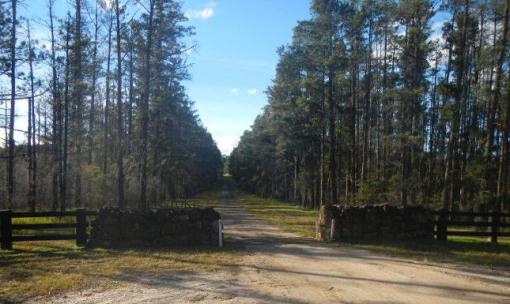
Itchenstoke Gates - Mt Tootie Road
|